
Exhibition Description
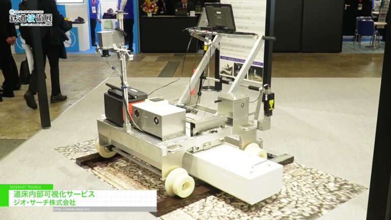
Geospatial Technologies, Aerial Photography, Augmented Reality, Cartography, Digital Terrain Analysis, Earth Observation and Satellite, GIS Software, Global Navigation Satellite System, Ground Penetrating Radar, Light Detection and Ranging, Modelling and Visualisation, Photogrammetry, Remote Sensing, Surveying, Topographic Surveys, Virtual Reality
This is the only unique exhibition in the ASEAN region related to technologies and services associated with geospatial information and location information. It is highly specialized and active in business negotiations with key figures. It is also an exhibition with high satisfaction ratings from exhibitors and visitors. It will be held with Ocean Connect Asia, an exhibition of marine science and technology, DRONES & UNCREWED ASIA which is a drone exhibition, and the DIGITAL CONSTRUCTION ASIA which is a digital construction exhibition. They offer opportunities for synergistic effects. The conference will feature over 100 speakers and attract participants from across the region.
Held with concurrent exhibitions.